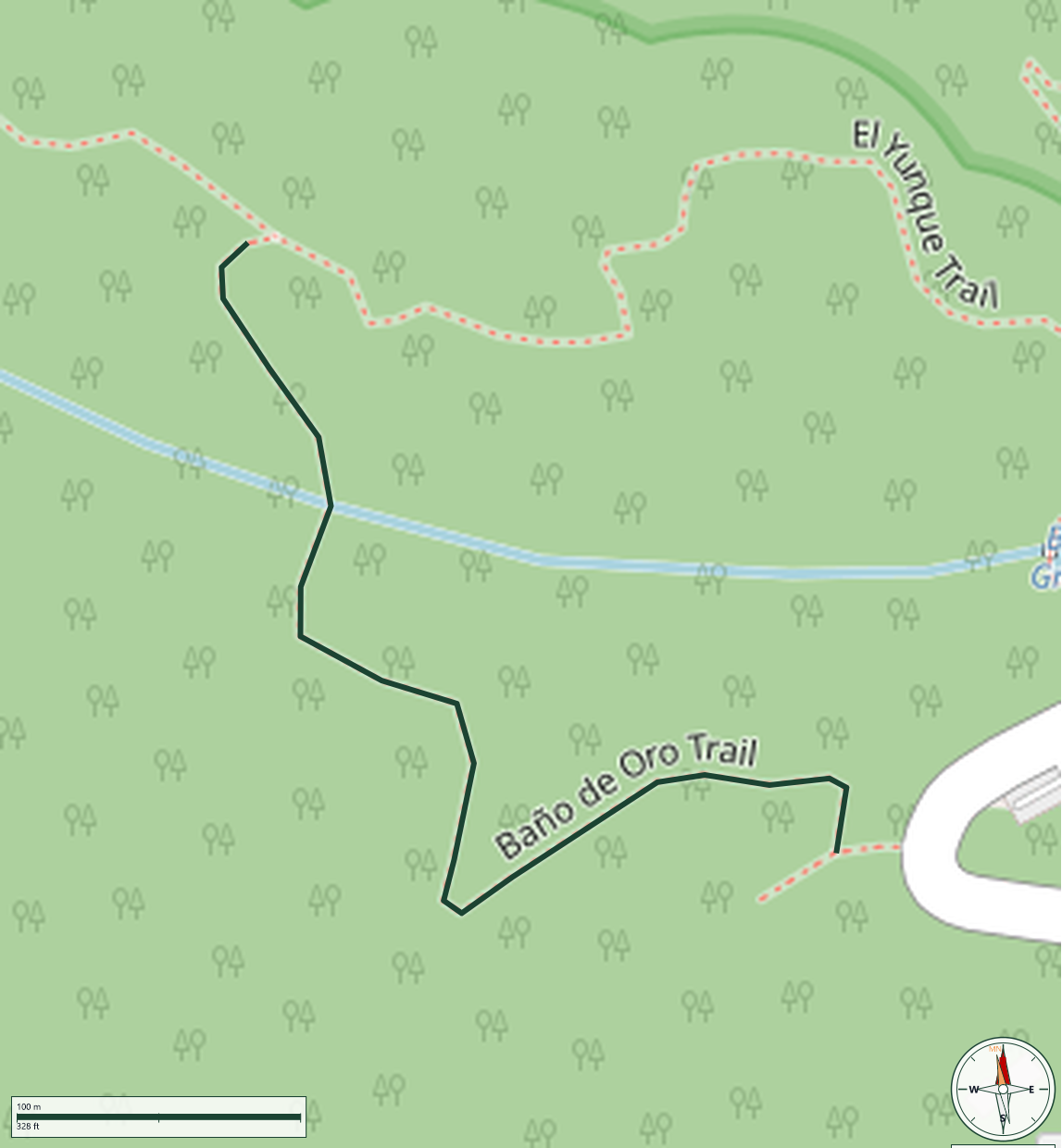
Trail Map
El Yunque National Forest
Safety Warning: Trail information comes from OpenStreetMap and may be incomplete or outdated. Verify conditions before heading out.
Find safety and preparation guides by the Council at: veredaspr.org/en/safety/
| Difficulty | Moderate | Distance | 1.0 km |
|---|---|---|---|
| Elevation gain | 70 m | Elevation loss | 70 m |
| Min elevation | 669 m | Max elevation | 739 m |
| Surface | — | Loop trail | No |
| Status | Unknown | Access | Public |
| Trailhead | 18.30070, -65.78622 | ||
Baño de Oro Trail is an easy 0.3-mile trail in El Yunque National Forest that winds through lush riverine forest, crossing two creeks before joining the El Yunque Trail. Along the way, hikers pass historic fish hatchery tanks from the 1930s, built during an unsuccessful attempt to breed trout in the area. Recently reopened after closure from Hurricane Maria damage, the trail surface can be slippery and prone to water accumulation in wet conditions. Access is from PR-191, km 12.25.
GPX track download available at: veredaspr.org/gpx/bano-de-oro-trail.gpx
VeredasPR is a free resource sponsored by the Puerto Rico Council of Scouting America to promote safe and responsible hiking.
Your contribution funds camp maintenance, youth outdoor programs, and community conservation projects across the island.