Trail Map
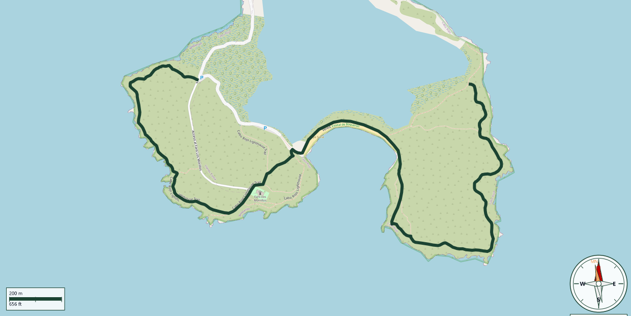
Boquerón State Forest · Cabo Rojo
Safety Warning: Trail information comes from OpenStreetMap and may be incomplete or outdated. Verify conditions before heading out.
Find safety and preparation guides by the Council at: veredaspr.org/en/safety/
| Difficulty | Moderate | Distance | 3.4 km |
|---|---|---|---|
| Elevation gain | 51 m | Elevation loss | 41 m |
| Min elevation | 0 m | Max elevation | 22 m |
| Surface | — | Loop trail | No |
| Status | Unknown | Access | Public |
| Trailhead | 17.93754, -67.19443 | ||
The hike across the Los Morrillos peninsula in Cabo Rojo offers a uniquely rugged coastal experience, winding through the Boquerón State Forest. Hikers traverse flat, gravelly paths and limestone cliffs that glow with reddish iron hues, offering constant panoramic views of the turquoise Caribbean Sea and the vibrant pink-tinted salt lagoons. Key waypoints include the historic 1882 Spanish neoclassical lighthouse perched atop 200-foot cliffs and the Puente de Piedra, a stunning natural stone arch carved by the surf. The environment is highly exposed with virtually no shade, so an early start is critical to avoid intense heat; arrive before 9:00 AM to secure a parking spot. Sturdy, closed-toe footwear is recommended over sandals due to the uneven, rocky terrain near the cliffs. The trail traverses Playa Sucia (La Playuela), a pristine, crescent-shaped beach perfect for cooling off after the trek. Because there are no services on-site, hikers must carry ample water and sun protection.
GPX track download available at: veredaspr.org/gpx/caminata-faro-los-morillos-playa-sucia.gpx
VeredasPR is a free resource sponsored by the Puerto Rico Council of Scouting America to promote safe and responsible hiking.
Your contribution funds camp maintenance, youth outdoor programs, and community conservation projects across the island.