Trail Map
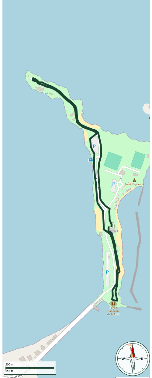
Toa Baja
Safety Warning: Trail information comes from OpenStreetMap and may be incomplete or outdated. Verify conditions before heading out.
Find safety and preparation guides by the Council at: veredaspr.org/en/safety/
| Difficulty | Moderate | Distance | 2.3 km |
|---|---|---|---|
| Elevation gain | 10 m | Elevation loss | 10 m |
| Min elevation | 0 m | Max elevation | 4 m |
| Surface | — | Loop trail | No |
| Status | Open | Access | Public |
| Trailhead | 18.46930, -66.13649 | ||
This walk follows the coastline of Isla de Cabras, a small island at the entrance to San Juan Bay that for centuries formed part of the city's defensive system and today preserves traces of its military and public-health history. The route connects three key stops: the ruins of the old leprosarium, where leprosy patients were isolated from the late 19th century until 1926; Fortín San Juan de la Cruz, known as El Cañuelo, built in 1610 to close off the bay entrance in a crossfire with Castillo San Felipe del Morro across the water; and Fuerte Amézquita, a World War 2 coastal-defense battery with 12-inch guns relocated from Fort Delaware in 1940. El Cañuelo was burned down during the 1625 Dutch assault on San Juan and rebuilt around 1670, evidence of its continued importance to the city's defenses. An ideal route for anyone looking to combine coastal views with over four centuries of military history.
GPX track download available at: veredaspr.org/gpx/caminata-isla-de-cabras.gpx
VeredasPR is a free resource sponsored by the Puerto Rico Council of Scouting America to promote safe and responsible hiking.
Your contribution funds camp maintenance, youth outdoor programs, and community conservation projects across the island.