Trail Map
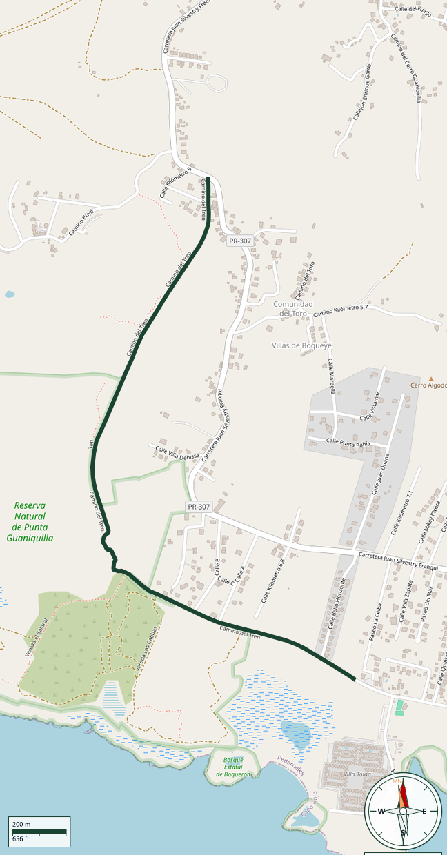
Punta Guaniquilla Nature Reserve · Cabo Rojo
Safety Warning: Trail information comes from OpenStreetMap and may be incomplete or outdated. Verify conditions before heading out.
Find safety and preparation guides by the Council at: veredaspr.org/en/safety/
| Difficulty | Moderate | Distance | 2.6 km |
|---|---|---|---|
| Elevation gain | 45 m | Elevation loss | 51 m |
| Min elevation | 7 m | Max elevation | 40 m |
| Surface | — | Loop trail | No |
| Status | Unknown | Access | Public |
| Trailhead | 18.05058, -67.18874 | ||
Route to the historic Guaniquilla Train Tunnel, built in 1908 as part of Puerto Rico's coastal railway and used until around 1956, when rail service in Cabo Rojo came to an end. The tunnel is located off PR-307, km 5.0 interior, in the Guaniquilla sector, near the Punta Guaniquilla Nature Reserve on private property.From the access point, the tunnel is reached in about three to four minutes on foot. The full route covers approximately 2.6 km through the dry coastal scrubland typical of southwestern Puerto Rico.
GPX track download available at: veredaspr.org/gpx/camino-tunel-de-guaniquilla.gpx
VeredasPR is a free resource sponsored by the Puerto Rico Council of Scouting America to promote safe and responsible hiking.
Your contribution funds camp maintenance, youth outdoor programs, and community conservation projects across the island.