Trail Map
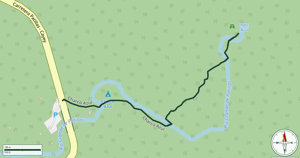
Carite State Forest · Patillas
Safety Warning: Trail information comes from OpenStreetMap and may be incomplete or outdated. Verify conditions before heading out.
Find safety and preparation guides by the Council at: veredaspr.org/en/safety/
| Difficulty | Easy | Distance | 0.7 km |
|---|---|---|---|
| Elevation gain | 21 m | Elevation loss | 6 m |
| Min elevation | 606 m | Max elevation | 627 m |
| Surface | paved | Loop trail | No |
| Status | Unknown | Access | Public |
| Trailhead | 18.09286, -66.03102 | ||
The trail leading to Charco Azul offers an accessible yet immersive trek through a dense subtropical forest. Winding parallel to the stream, the path features lush vegetation, river crossings via small bridges, and the soothing sounds of local wildlife. It culminates at a large, deep swimming hole famous for its striking turquoise and blue hues, caused by mineral composition and sunlight reflection. It is an excellent spot for swimming, birdwatching, and photography.
GPX track download available at: veredaspr.org/gpx/charco-azul.gpx
VeredasPR is a free resource sponsored by the Puerto Rico Council of Scouting America to promote safe and responsible hiking.
Your contribution funds camp maintenance, youth outdoor programs, and community conservation projects across the island.