Trail Map
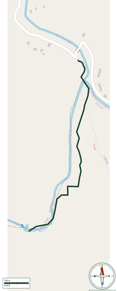
Ciales
Safety Warning: Trail information comes from OpenStreetMap and may be incomplete or outdated. Verify conditions before heading out.
Find safety and preparation guides by the Council at: veredaspr.org/en/safety/
| Difficulty | Expert | Distance | 1.0 km |
|---|---|---|---|
| Elevation gain | 59 m | Elevation loss | 10 m |
| Min elevation | 209 m | Max elevation | 268 m |
| Surface | — | Loop trail | No |
| Status | Unknown | Access | Public |
| Trailhead | 18.25749, -66.50133 | ||
Charco el Morón is a rewarding backcountry destination for hikers seeking a rugged, unmaintained trail that leads to a dramatic natural swimming pool on the Ciales-Orocovis border. The trek requires a 30- to 60-minute technical scramble directly up the rocky riverbed of the Río Toro Negro, demanding excellent balance, high-traction water footwear, and constant awareness of sudden mountain flash floods (golpes de agua). Your efforts are paid off upon arrival at an enclosed canyon oasis featuring sheer rock walls, a plunge depth of 27 feet, and a thrilling 45-foot cliff jump—though because there is no shallow shoreline, hikers must be confident swimmers or bring flotation gear.
GPX track download available at: veredaspr.org/gpx/charco-el-moron.gpx
VeredasPR is a free resource sponsored by the Puerto Rico Council of Scouting America to promote safe and responsible hiking.
Your contribution funds camp maintenance, youth outdoor programs, and community conservation projects across the island.