Trail Map
Cataño
Safety Warning: Trail information comes from OpenStreetMap and may be incomplete or outdated. Verify conditions before heading out.
Find safety and preparation guides by the Council at: veredaspr.org/en/safety/
| Difficulty | Moderate | Distance | 3.0 km |
|---|---|---|---|
| Elevation gain | 13 m | Elevation loss | 15 m |
| Min elevation | -1 m | Max elevation | 5 m |
| Surface | — | Loop trail | No |
| Status | Unknown | Access | Public |
| Trailhead | 18.44332, -66.12937 | ||
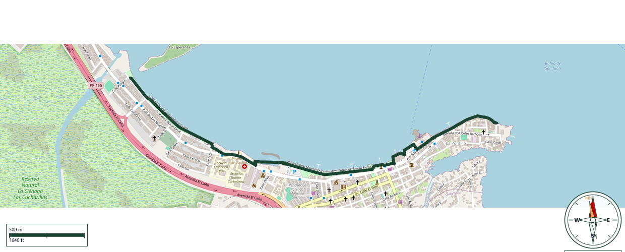
This completely flat, paved coastal route runs along Las Nereidas Avenue in Cataño, offering an open and straightforward path ideal for walkers, runners, and cyclists of all skill levels. The route is highly regarded for its uninterrupted, scenic views across the bay toward San Juan and Old San Juan. As a shared urban multi-use path, it features wide sidewalks and pedestrian-friendly spaces, making it perfect for seamless exercise while connecting directly to the Cataño Ferry Terminal and the local culinary district. Sun protection is highly recommended, as the entire path is fully exposed to the sun.
GPX track download available at: veredaspr.org/gpx/frente-maritimo-de-catano.gpx
VeredasPR is a free resource sponsored by the Puerto Rico Council of Scouting America to promote safe and responsible hiking.
Your contribution funds camp maintenance, youth outdoor programs, and community conservation projects across the island.