Trail Map
El Yunque National Forest
Safety Warning: Trail information comes from OpenStreetMap and may be incomplete or outdated. Verify conditions before heading out.
Find safety and preparation guides by the Council at: veredaspr.org/en/safety/
| Difficulty | Hard | Distance | 0.5 km |
|---|---|---|---|
| Elevation gain | 0 m | Elevation loss | 67 m |
| Min elevation | 868 m | Max elevation | 935 m |
| Surface | dirt | Loop trail | No |
| Status | Unknown | Access | Public |
| Trailhead | 18.30955, -65.78901 | ||
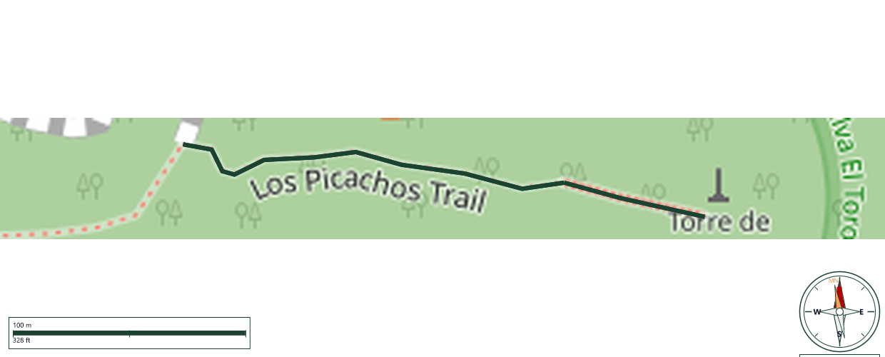
Los Picachos Trail is a short but strenuous 0.2-mile spur off the El Yunque Trail that climbs an extremely steep stone staircase to a masonry platform at 3,175 feet in the Elfin Woodland Cloud Forest. From the summit, hikers are rewarded with a 360-degree panoramic viewpoint with particularly impressive vistas toward the eastern coast of Puerto Rico. Despite the brief distance, the steep stone steps demand significant effort. Access is exclusively via the El Yunque Trail.
GPX track download available at: veredaspr.org/gpx/los-picachos-trail.gpx
VeredasPR is a free resource sponsored by the Puerto Rico Council of Scouting America to promote safe and responsible hiking.
Your contribution funds camp maintenance, youth outdoor programs, and community conservation projects across the island.