Trail Map
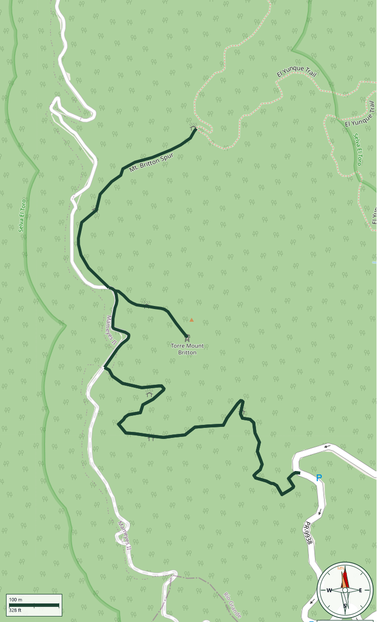
El Yunque National Forest
Safety Warning: Trail information comes from OpenStreetMap and may be incomplete or outdated. Verify conditions before heading out.
Find safety and preparation guides by the Council at: veredaspr.org/en/safety/
| Difficulty | Moderate | Distance | 2.6 km |
|---|---|---|---|
| Elevation gain | 0 m | Elevation loss | 143 m |
| Min elevation | 746 m | Max elevation | 889 m |
| Surface | concrete | Loop trail | No |
| Status | Unknown | Access | Public |
| Trailhead | 18.30044, -65.79472 | ||
Mt. Britton Trail is a challenging 0.8-mile route that rapidly ascends 591 feet through Sierra Palm forest and Cloud Forest to the summit at 3,087 feet. The highlight is the historic Mt. Britton Tower, a stone observation tower built by the Civilian Conservation Corps in 1937–38 and recognized as the tallest CCC stone masonry tower of its kind. On clear days, the observation deck offers panoramic views spanning the Atlantic Ocean, Caribbean Sea, and Puerto Rico's eastern coastal plain.
GPX track download available at: veredaspr.org/gpx/mt-britton-trail.gpx
VeredasPR is a free resource sponsored by the Puerto Rico Council of Scouting America to promote safe and responsible hiking.
Your contribution funds camp maintenance, youth outdoor programs, and community conservation projects across the island.