Trail Map
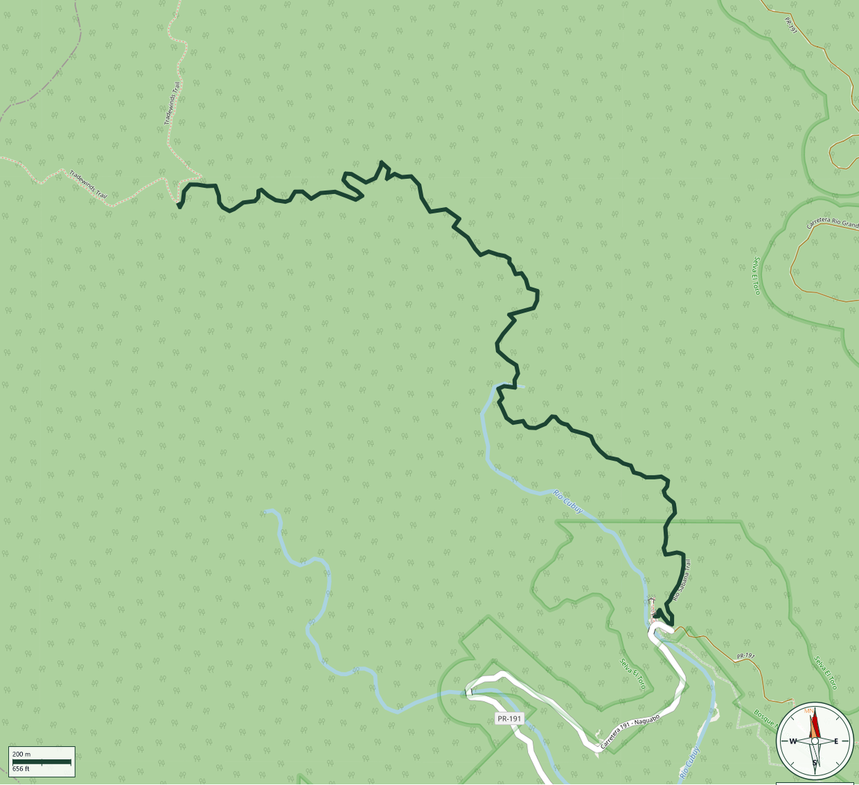
El Yunque National Forest
Safety Warning: Trail information comes from OpenStreetMap and may be incomplete or outdated. Verify conditions before heading out.
Find safety and preparation guides by the Council at: veredaspr.org/en/safety/
| Difficulty | Moderate | Distance | 4.0 km |
|---|---|---|---|
| Elevation gain | 390 m | Elevation loss | 59 m |
| Min elevation | 495 m | Max elevation | 826 m |
| Surface | ground | Loop trail | No |
| Status | Unknown | Access | Public |
| Trailhead | 18.26766, -65.79508 | ||
Río Sabana Trail is a challenging 2.9-mile wilderness route that forms a key north-south corridor through El Yunque National Forest in the Naguabo sector, climbing 1,168 feet in elevation. Originally built in the 1930s by the Civilian Conservation Corps and rehabilitated in 2011, the trail traverses natural ground surfaces through remote backcountry. Between El Toro Peak and the Tradewinds/Río Sabana junction, vegetation and landslides may require route-finding skills. Cell phone coverage is minimal; thorough preparation is essential.
GPX track download available at: veredaspr.org/gpx/rio-sabana-trail.gpx
VeredasPR is a free resource sponsored by the Puerto Rico Council of Scouting America to promote safe and responsible hiking.
Your contribution funds camp maintenance, youth outdoor programs, and community conservation projects across the island.