Trail Map
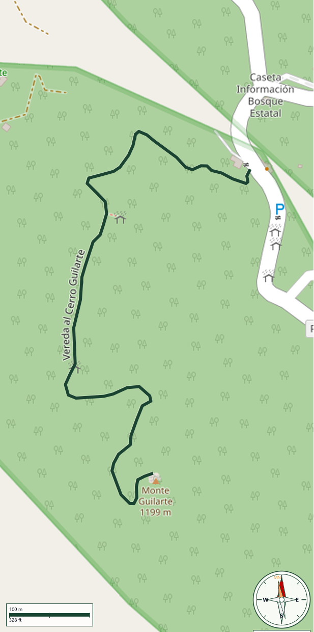
Guilarte State Forest · Adjuntas
Safety Warning: Trail information comes from OpenStreetMap and may be incomplete or outdated. Verify conditions before heading out.
Find safety and preparation guides by the Council at: veredaspr.org/en/safety/
| Difficulty | Hard | Distance | 0.9 km |
|---|---|---|---|
| Elevation gain | 112 m | Elevation loss | 0 m |
| Min elevation | 1025 m | Max elevation | 1137 m |
| Surface | — | Loop trail | No |
| Status | Unknown | Access | Public |
| Trailhead | 18.14531, -66.76789 | ||
The Vereda al Cerro Guilarte is the official summit trail inside Guilarte State Forest, in the municipality of Adjuntas. In under a kilometer, it climbs 112 meters to reach 1,137 m above sea level, topping out on Monte Guilarte — the sixth-highest peak in Puerto Rico, with its highest point at 1,204 m (3,950 ft). The route passes through dense mountain forest with cloud-level vegetation, frequent mist, and temperatures noticeably cooler than the coast. On clear days, the summit offers panoramic views across the Cordillera Central and Puerto Rico's mountainous interior. The forest has been protected as a state reserve since 1935 and is one of the most visited highland forests on the island.
GPX track download available at: veredaspr.org/gpx/vereda-al-cerro-guilarte.gpx
VeredasPR is a free resource sponsored by the Puerto Rico Council of Scouting America to promote safe and responsible hiking.
Your contribution funds camp maintenance, youth outdoor programs, and community conservation projects across the island.