Trail Map
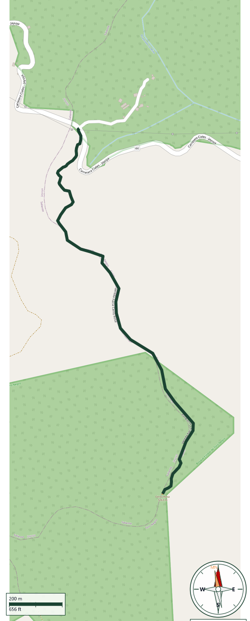
Ciales
Safety Warning: Trail information comes from OpenStreetMap and may be incomplete or outdated. Verify conditions before heading out.
Find safety and preparation guides by the Council at: veredaspr.org/en/safety/
| Difficulty | Expert | Distance | 1.9 km |
|---|---|---|---|
| Elevation gain | 378 m | Elevation loss | 18 m |
| Min elevation | 877 m | Max elevation | 1237 m |
| Surface | dirt | Loop trail | No |
| Status | Unknown | Access | Public |
| Trailhead | 18.19114, -66.53534 | ||
Cerro Rosa Trail via Jayuya Located in Puerto Rico’s central mountain range along the border of Jayuya and Ciales, the route to Cerro Rosa offers a rigorous, backcountry hiking experience. Standing as the island’s third-highest peak at 1,263 meters (4,144 feet), the summit provides a true wilderness trek through dense high-altitude cloud forest. Distance & Trail Type: Approximately 4.8 kilometers (3 miles) out-and-back. Terrain & Navigation: The trail is largely unmaintained and can be heavily overgrown with thick, thorny brush. Hikers should expect steep initial inclines, uneven terrain, and obstacles such as fallen trees. Reliable GPS navigation tools are highly recommended, as the path can easily become obscured. Gear Recommendations: Long pants and long sleeves are essential to protect against scratchy undergrowth. Sturdy hiking boots with excellent traction, work gloves for clearing brush, and a sufficient supply of water and snacks are required for this demanding climate. This route sees very low foot traffic, making it ideal for self-sufficient hikers looking for a remote and physically challenging mountain ascent.
GPX track download available at: veredaspr.org/gpx/vereda-hacia-cerro-rosa.gpx
VeredasPR is a free resource sponsored by the Puerto Rico Council of Scouting America to promote safe and responsible hiking.
Your contribution funds camp maintenance, youth outdoor programs, and community conservation projects across the island.